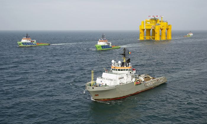
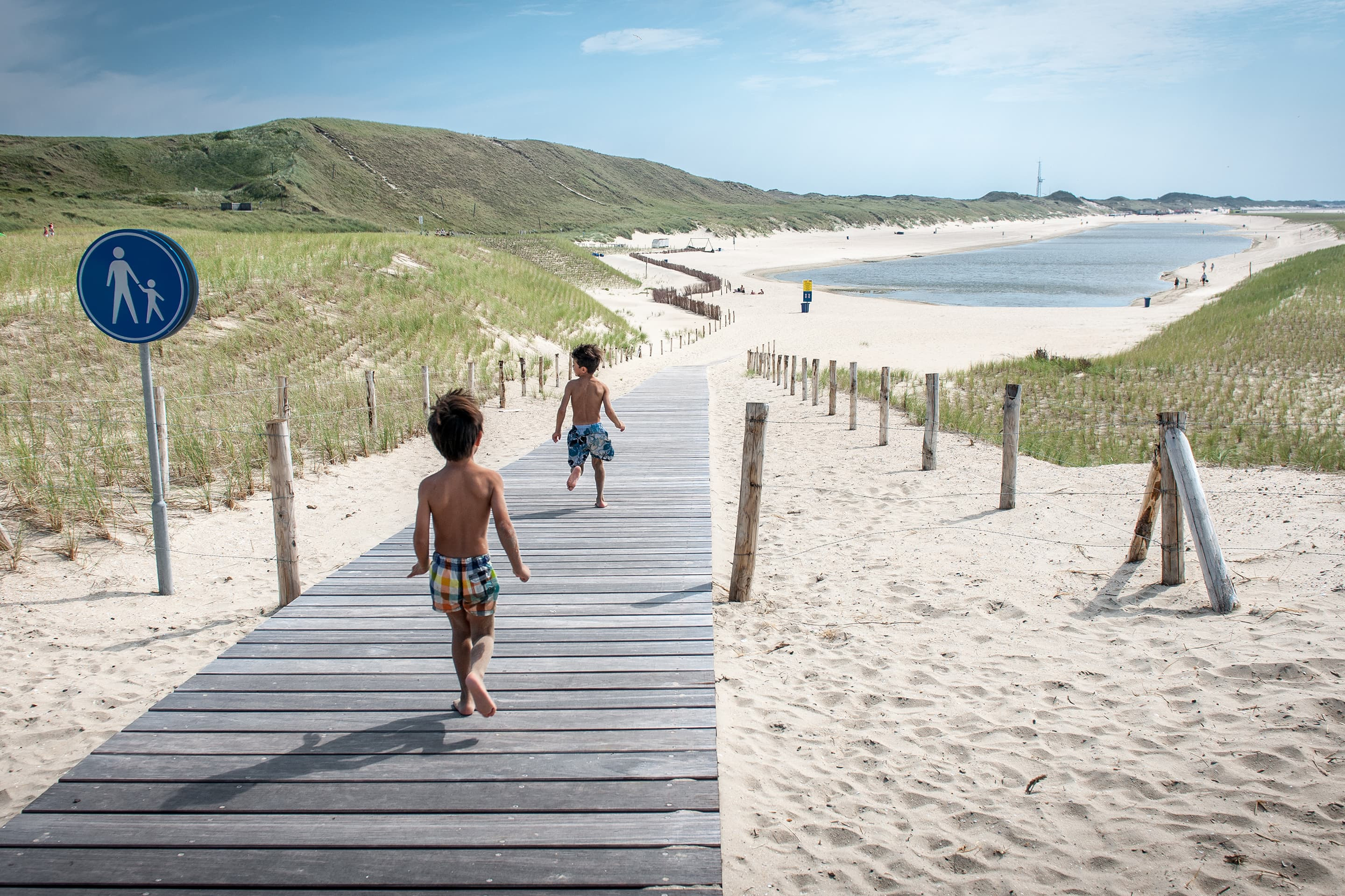
With much of the country below sea level, the Netherlands has had to battle to fend off the ravages of the sea for centuries. The Netherlands is arguably the most flood protected country in the world, but the Dutch know they have to stay one step ahead.
The Dutch government has opted for various solutions. A unique aspect is the combination of flood protection and area development: it is seen as an opportunity to enhance the spatial quality of the area, through urban and landscape embellishment and more recreational facilities. Boskalis is involved in a large number of leading projects. Gert Verzijl, Boskalis Director Projects Rivers and Dikes in the Netherlands: “They show our track record as a developer of economically and ecologically sound infrastructure works in vulnerable localities. Innovation, co-creation through partnerships with knowledge institutions and stakeholder management are key aspects in these projects.”
Room for the River
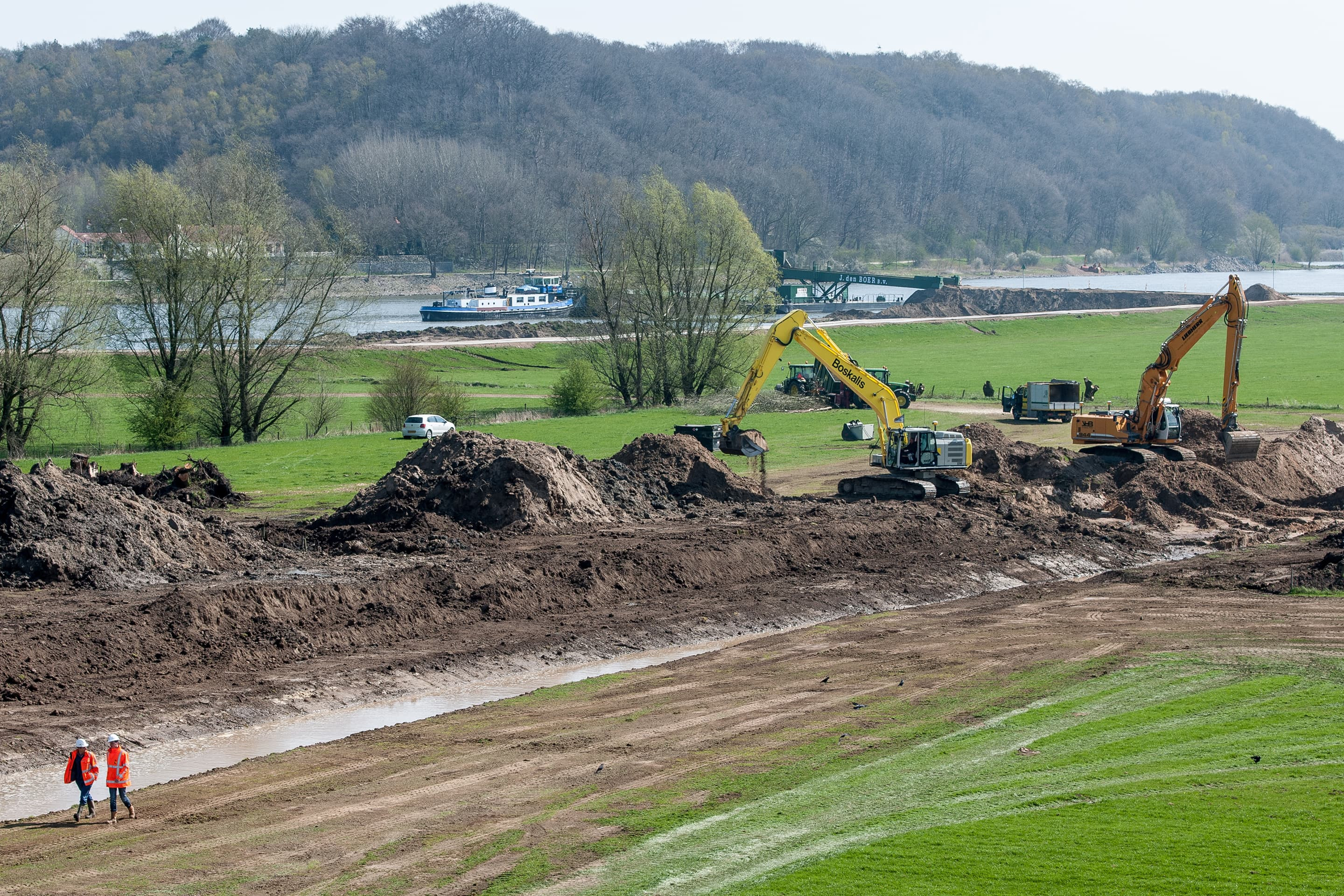
In the Netherlands rivers are having to deal with increasing amounts of rain and meltwater, which led to flooding in 1993 and 1995. With a budget of 2.2 billion Euros the Dutch government’s ‘Room for the River’ program is designed to provide more space for the rivers the Rhine, the Meuse, the Waal and the IJssel.
Expanding the rivers rather than raising the dikes marks a turning point in the approach to flood protection. The Dutch government has opted for various solutions, including widening the floodplains, building dams, lowering groins and even ‘depolderization’. The aim is not just to protect the areas around the rivers, but also to structure the surroundings in the best and most attractive way possible. As part of the ‘Room for the River’ program, there are thirty flood-protection projects in the Netherlands.
Boskalis is involved in many of these projects. Undoubtedly their success is based on innovative solutions, co-creation through partnerships and stakeholder management. Here we highlight just a few of the initiatives to which our team has contributed in finding the best, tailored solution for individual rivers and their surrounding environment.
The New Merwede River: protection through depolderization
The Netherlands has long been associated with polders, ever since its engineers became renowned for developing techniques to drain wetlands or reclaim land from the sea and make them usable for agriculture and other development. This is well illustrated by the English saying: “God created the world but the Dutch created Holland.” In an unusual project, one of the famous Dutch polders is being handed back to nature. To reduce the risk of flooding on the New Merwede River, water has to flow faster when its level rises. A large-scale ‘depoldering’ project was embarked upon.
Taking place between 2011 and 2015, this project involves creating a floodplain at the ‘Noordwaard’. This is an area covering approximately 4,450 hectares — approximately 6,000 soccer pitches — in the province of Noord Brabant. Part of the Noordwaard will be ‘depolderized’, restructured and transformed into an intertidal area, through which large amounts of river water will flow to the sea.
Work includes the construction of creeks, dikes, mounds, bridges, pumping stations, roads and channels and a range of soil remediation operations. Sustainable solutions are characteristic features of the approach. Cooperation with local residents, businesses and stakeholders has been crucial to the success of this project.
The number of areas with dike protection in the Noordwaard was reduced and a new ‘Green Wave reducing dike’ was built. To spare the local residents from having to look out onto a higher newly-built dike, a 100 meter-wide willow forest was planted on the river side of the dike. Every other year the willows will be pruned back so that the stumps produce shoots which will catch a large part of the wash. By regularly replacing the willows they are expected to be able to absorb up to 80 per cent of the waves’ energy. Farmers and local residents were given the option of staying in the ‘depolderized’ Noordwaard by relocating their houses and some buildings to the tops of mounds to protect them.
The new landscape will be a resting place for birds throughout the year and the combination of the river discharge and the tides will create opportunities for major nature developments that are unique in Western Europe.
Cors van Poortvliet, Boskalis Project Manager, says: “It really is a privilege to work on this project. I certainly agree with Eric Luiten, Chairman of the Dutch government’s Quality Team of the Room for the River Projects, who considers the Noordwaard project to be one of their crown jewels in terms of landscaping.”
Lower Rhine River: the first ‘Plan, Design and Construct’ contract
The Lower Rhine flood-protection project was the very first ‘Plan, Design & Construct’ contract in the Netherlands, so Boskalis is particularly proud to have been involved in this project.
Spread out over a distance of 40 kilometers, the Lower Rhine project includes four locations located between Doorwerth and Elst over a length of approximately 8 kilometers. Between 2011 and 2014 Boskalis widened parts of the river to enable it to drain off more water. Considerable attention had to be paid to the spatial quality of each area. This covered a broad range of activities including the enhancement of sight lines, construction of grasslands and riparian forests, conservation of an old factory chimney, creation of a high-water bridge and footpaths, bicycle paths and parking areas for visitors. Because this was the first ‘Plan, Design & Construct’ contract, a new approach was required right from the tender phase. The client, the Dutch government, provided only a rough target for the project and then it was up to Boskalis, in collaboration with the engineering firm Grontmij, to convince the government of their expertise in this area. Additionally, there were three major challenges: managing the time factor (the earlier the project was finished, the better), creating support locally (it was vital to get as many stakeholders on board as possible) and price (staying within budget).
Dirk-Jan Zwemmer, Boskalis Project Manager: “Our approach exceeded our client’s expectations for every challenge. In effect, the processes of generating support and design moved ahead in parallel and that saved a lot of time. We finished within budget with 3 out of 4 locations one year earlier (that’s two high-water seasons) than specified.”
Waal River
The Waal River flood protection program, taking place between 2012 and 2015, involved a pilot project for the Dutch government, whereby Boskalis had to lower groins and, in part, replace them with dams. This project has eventually involved adjusting 365 groins and building two dams.
As a result of the increase in the river discharge rate, erosion of the navigation channel and the position of the groins in the Waal River, the water level has risen in recent years. Therefore the groins constituted an unnecessarily large obstacle to the discharge of water.
Under the pilot project for the Dutch government, which Boskalis is executing with Van den Herik, the discharge capacity of the river needed to be increased by lowering the groins between Gorinchem and Nijmegen by approximately 1 meter and replacing them in part with dams in the direction of the river. The construction of this kind of dam is a first in the Netherlands. Boskalis is contributing the expertise of its own engineering consultancy and other support services, elaborating on the technical design and developing the working methods.
Preparations and the permit applications began in the first six months of 2013. A risk survey was conducted for each groin that included an assessment of whether there were possible difficulties that could lead to objection proceedings in areas such as archaeology, ecology, the environment, unexploded ordnance, leisure facilities, underground infrastructure or the interests of local residents. Crucially, the impact on local residents has been limited by using boats for transport of materials to and from the project site.
Operations began in mid-2013. Proof is also required that the groin and dam structures are, and will remain, sand-proof. Given the fact that a large part of the project is conducted below the waterline, these checks are conducted using surveying techniques. As on the other ‘Room for the River’ projects, sound location management is a crucial component of this project.
Eventually 365 groins have been lowered, extended, removed and upgraded, improving the flow of the river water between Dalem and Dodewaard. During periods of high water, the water level will now be between 6 and 12 centimeters lower. Two dams measuring seven and four kilometers are also being built in the direction of the river in the section between Wamel and Ophemert.
Jos van Oijen, Project Leader, says: “This project not only created a safer environment but also has a positive impact on the development of flora and fauna. The need for maintenance dredging has also been reduced.”
IJssel River: 71 centimeters water level reduction
The flow of the River IJssel needs improving to reduce the likelihood of flooding. The measures taken mean that the water level of the river will be temporarily reduced by 71 centimeters when extreme flood levels are expected. Along the Veessen-Wapenveld section of the IJssel River, a high-water channel is being constructed between two dikes in a three year project running from 2014 to 2017. It is important that natural and agricultural values in the area will be maintained and, if possible, enhanced and that local disruption is kept to a minimum. To achieve this, instead of digging a channel through the area, two eight kilometer-long new dikes are being built. This will result in a high-water channel that is between 500 and 1,500 meters wide and can accommodate 45 per cent of the water flowing through the River IJssel at extremely high water levels. The channel acts as a ‘bypass’, preventing the river from bursting its banks. When the channel is full, it will temporarily lower the level of the IJssel by 71 centimeters. This is the largest reduction achieved by a project in the Dutch Room for the River program.
Thijs Woolderink, Boskalis Project Leader, comments: “To reduce local disruption and eliminate the need to use the roads, we used the River IJssel to bring in all the materials required, such as the machines and the basic materials for concrete, asphalt, sand and clay. Furthermore, the sand required for the dikes was pumped in through pipelines. This resulted in a considerable reduction of truck traffic and improved road safety during the work.”
”The farming potential between the dikes will be maintained and the natural features of the area will also be a focal point. A new nature and meadow bird reserve will be created. Furthermore, the plan includes better bicycle links and, with the construction of two new bridges, proper access to the area will be maintained.”
Expanding the rivers rather than raising the dikes marks a turning point in the approach to flood protection.
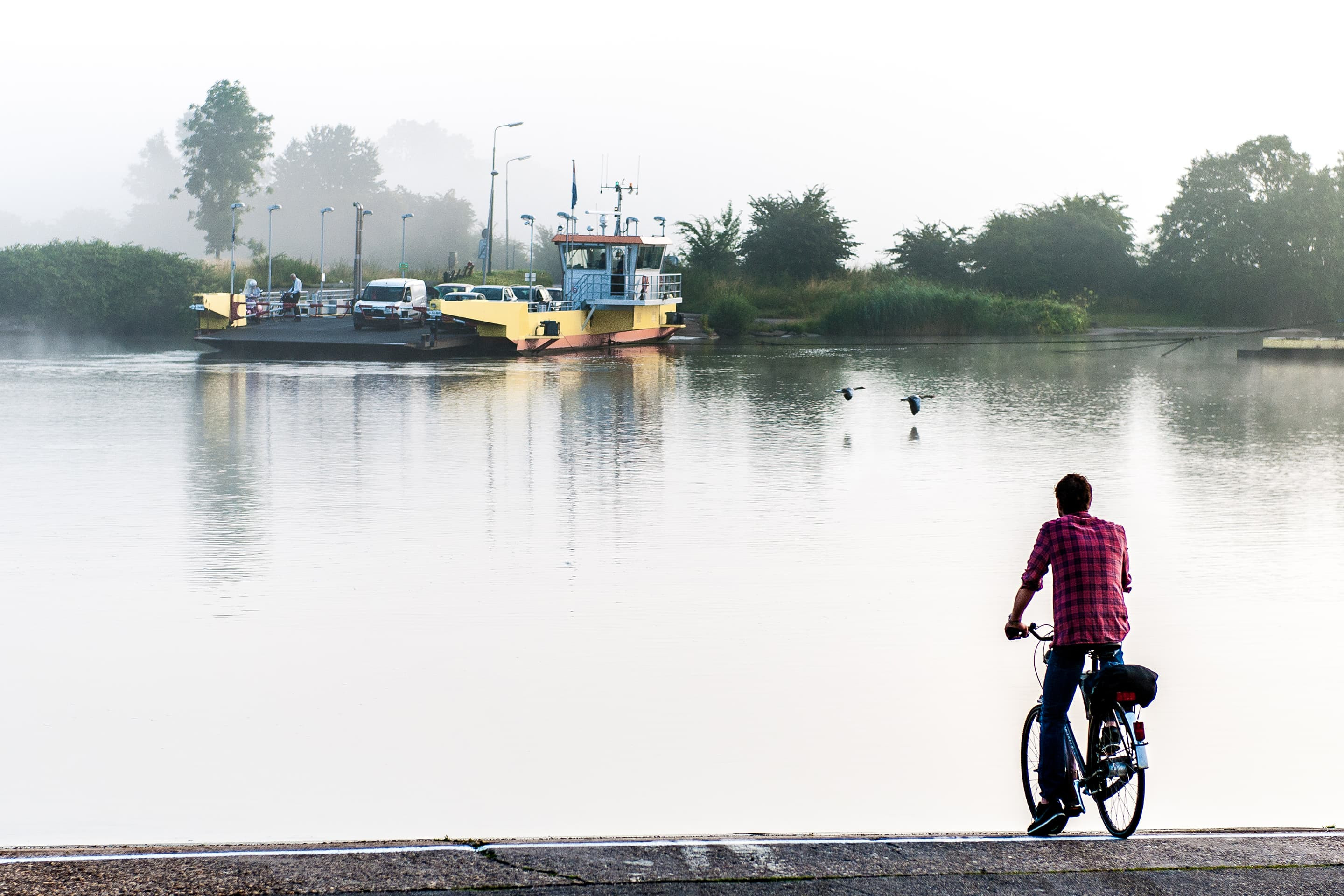
IJssel River, Deventer
Deventer is a city with a rich history, in which the River IJssel has played a prominent role. Historically, the heart of the city has always been linked to the opposite bank of the river by a ferry. To reduce the likelihood of flooding, the water in the River IJssel needs to be discharged faster when water levels rise.
In a four-year project (2011–2015), the flood plains are being deepened by digging six secondary channels. By digging channels over a stretch of 10 kilometers in the flood plains, more water can flow through the river, reducing the risk of flooding. Leisure facilities are also being created.
The Engineer & Construct project is being executed by the IJsselfront consortium, which consists of Boskalis and Van Hattum & Blankevoort, who are responsible for the construction of a submerged retaining wall, a quay wall and changes to the piers of the Wilhelmina Bridge. The engineering firm Witteveen + Bos is providing support for the project. Communications with stakeholders are crucial. They include several municipal and provincial authorities, the water authority, the Dutch government, the Dutch National Forestry Department and the IJssellandschap Foundation, which manages a lot of the land, as well as water sports associations, anglers, environmental groups, walkers and local residents.
Project Leader, Gertjan Timmers, explains: “In consultation with our stakeholders the designs were approved and the works were undertaken. Large parts of the project have already been completed and are back in use!”
“Connecting up the ground flows was one of the big challenges in this project. This involved moving 2.7 million m3 of soil, sand and clay. We are aiming to reuse this as effectively as possible. The last part of the sand is being taken to our IJssel project near Veessen-Wapenveld, where we are constructing a high-water channel between two dikes.”
The work will not only reduce floods but will result in a new landscape for both nature and leisure activities. A new water sports complex has been built by the consortium in the Zandweerd Lake and the Bolwerk Lake will acquire, in addition to a 300 meter-long quay wall, a new jetty for the ferry across the River IJssel, inspired by the old pontoon bridge. Currently, the final elements of the infrastructure, such as the jetty, are being constructed. The whole project has to be completed before the end of 2015.
This is the largest reduction achieved by a project in the Dutch Room for the River program.
IJssel River, Kampen
To protect the area around Zwolle and Kampen from flooding, the River IJssel needs to be given more room. Several flood protection measures are being put in place during the project, which will run from 2014 to 2019, including river deepening, the construction of dikes, a bypass, locks, floodgates and an ‘inlet’ to the bypass.
In late 2014 preparations on the IJssel Delta project got underway. This is the final and second largest project in the ‘Room for the River’ program.
The region will be protected by the construction of 18 kilometers of dikes, a bypass to the Dronter Lake, additional flood defenses and the deepening of a seven-kilometer stretch of the IJssel River. Additionally, the bypass area of 713 hectares will be flooded during high water periods. During high water the river level will actually drop by 41 centimeters. In addition to the extensive earthmoving and dredging activities, Boskalis will be responsible for the integral management of the project through the central organization, which also represents Van Hattum & Blankevoort and Vialis. Van Hattum & Blankevoort is focusing on the civil engineering structures, such as locks and bridges. Vialis will manage the operation and control of structures including the locks.
Dirk-Jan Zwemmer, Project Leader, comments: “We are largely responsible for deciding on the architecture, design and the approach to the construction of the structures, of which there are quite a few. The contract requires the construction of a lock for leisure craft, a 400 meter-long bridge, a new pumping station, changes to the existing pumping stations and to the Roggebot Lock, as well as the design of two floodgates to divert the water from the bypass in a northerly direction. We will also be designing the control center for the lock doors. One high-profile element is the ‘inlet’ to the bypass. This will be a large structure to ensure that water can flow into the bypass in a controlled manner when water levels are high. The inlet will be 250 meters long, consist of 23 openings with concrete gates that will be raised when water levels are high.”
He adds: “The river expansion is seen as an opportunity to enhance the spatial quality of the river area, through urban and landscape embellishment and with the addition of more recreational facilities. When we have finished, there will be about 400 hectares with footpaths and cycle paths, where old dikes and ponds will be preserved as much as possible. We are creating a new, safe and peaceful part of the Netherlands here. That is a unique situation and our entire project team thinks a really fantastic job has been done!”
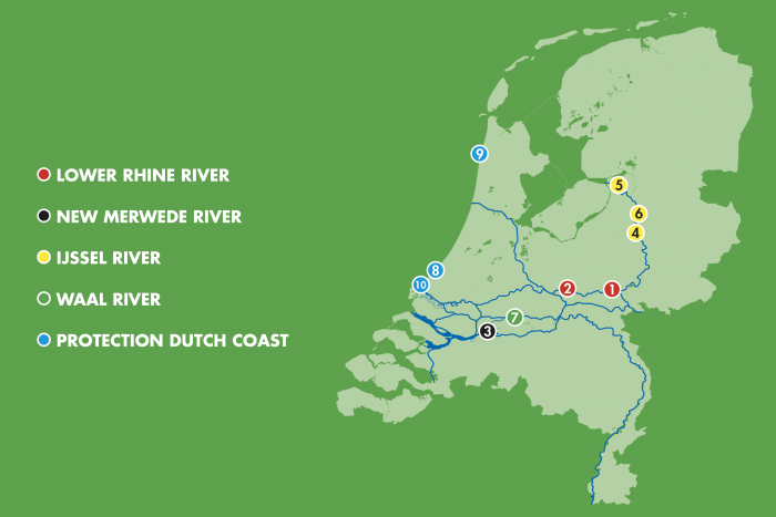
Boosting Dutch Flood Defenses by Boskalis: 1 Doorwerth and Elst, 2 Tollewaard, 3 Noordwaard, 4 Deventer, 5 Kampen, 6 Veessen – Wapenveld, 7 Waal River, 8 Delflandse coast, 9 Hondsbossche and Pettemer Sea Defense, 10 Sand Motor
A Super Storm Solution Dutch Style
Following the tragic and catastrophic flood of 1953, when nearly 2,000 people died in the Netherlands, the Dutch Delta Committee was established. The Dutch government called this Committee into action again in September 2007 to investigate how to protect the country from climate change and rising sea levels for the next century and beyond. This resulted in the Delta Plan — ‘Working together with water’ — being published in September 2008.
The plan presents an integrated vision on the long-term protection of the Dutch coast and its hinterland. On the protection of the Dutch coast it includes ten recommendations for adaptations, addressing the so-called ‘weak links’. The plan urges the strengthening of these weak links so that they are able to withstand a ‘super storm’ - an event that is expected to occur once every 10,000 years. Safety is of the utmost importance, but other objectives also play a role in these coastal reinforcement projects. For example, the sand balance should be kept stable, the ecological quality must be improved, the economic continuity must be guaranteed and the spatial use must be optimized.
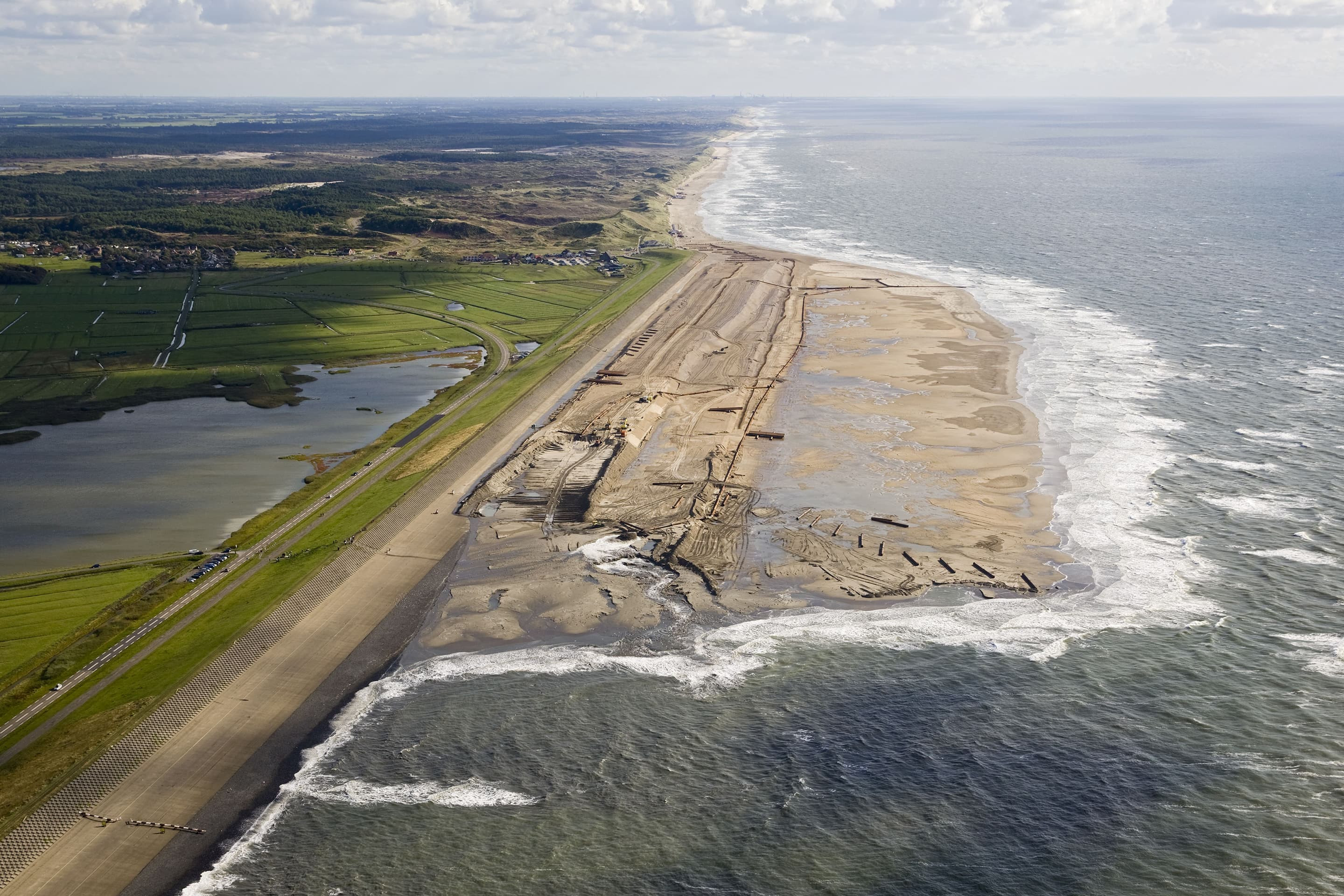
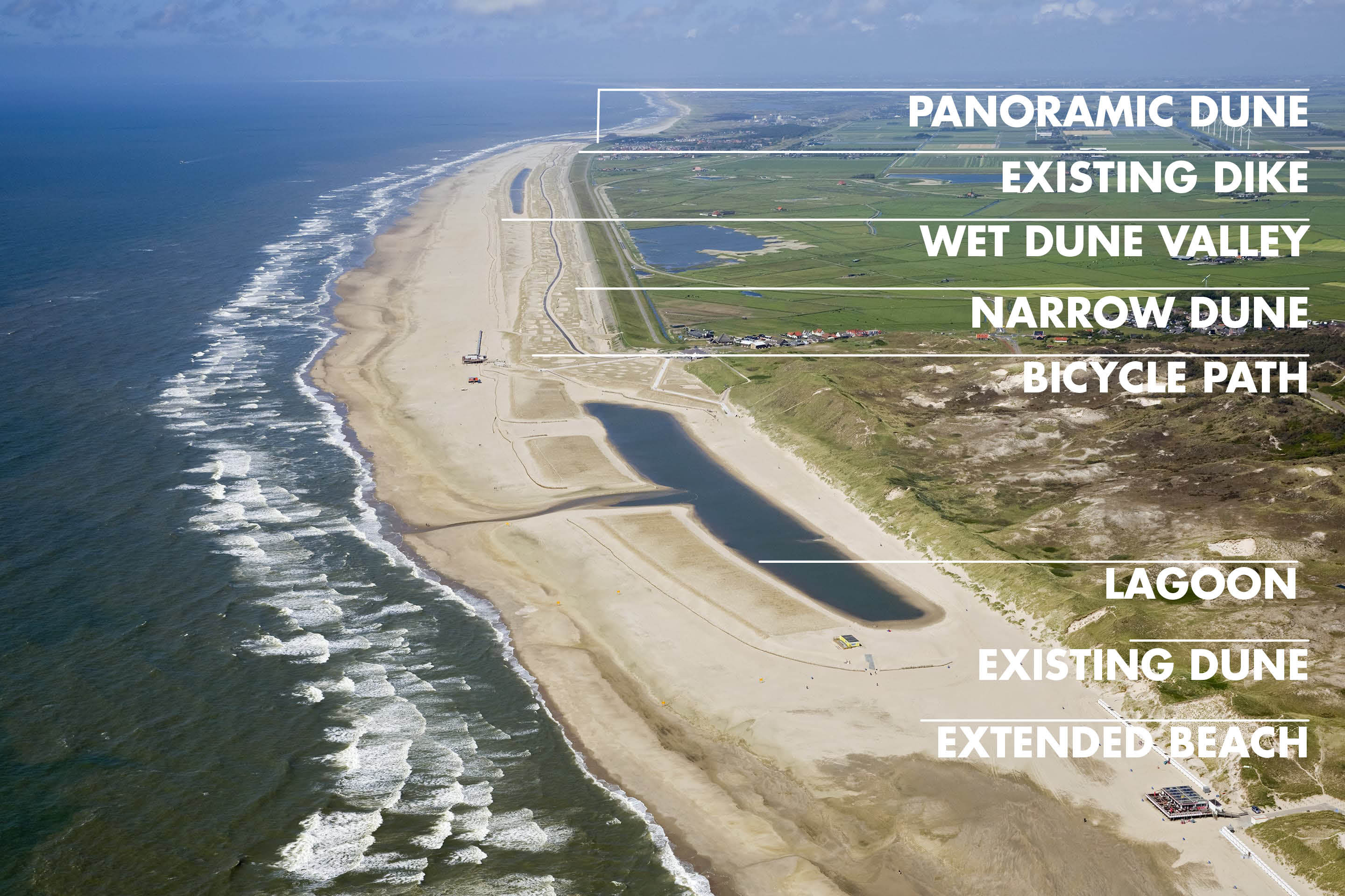
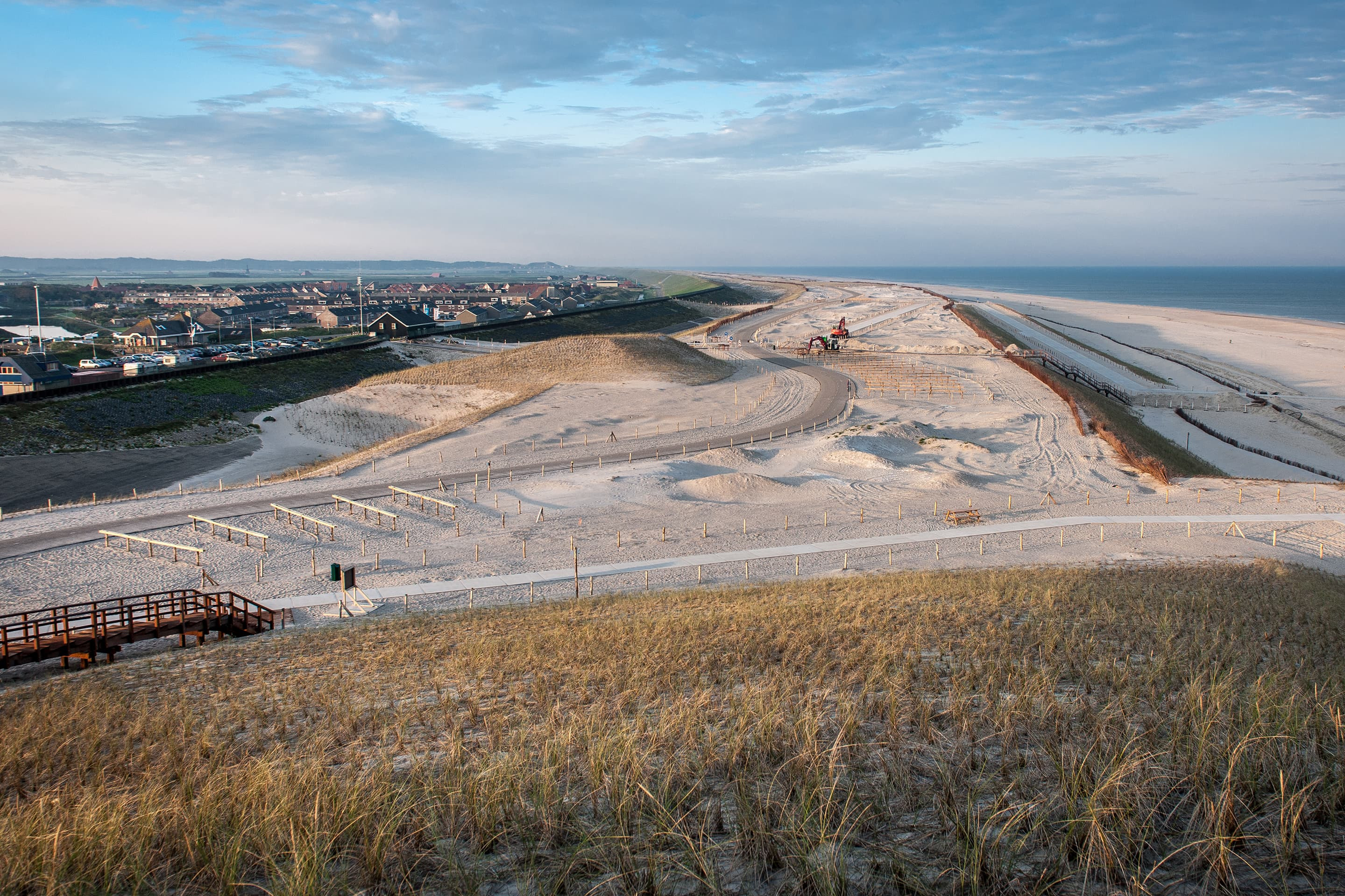
Boskalis already contributed to these projects with the reinforcement of the Delflandse coast and the creation of the Sand Motor. The Hondsbossche Sea Defense at Petten was considered the last weak link. The safety of the entire region, including large parts of the Dutch capital Amsterdam, depends on this dike, so it was paramount that a safer solution was found. Boskalis, in partnership with Van Oord, transformed the existing Hondsbossche and Pettemer Sea Defense into an unique beach and dune landscape. On the face of it, the new solution appears to be a softer alternative rather than making the defense even stronger. Boskalis Project Leader, Frank van Vliet, explains. “An obvious solution would have been to reinforce the existing dike. But that would have involved measures such as strengthening the dike on the landward side which, in this case, includes residential areas. That would have made the operation really expensive. What’s more: you can reinforce a dike, but when the time comes that further measures are needed — for example because of rising sea levels — then you have to make yet another drastic intervention. The solution we implemented is highly adaptive: the dunes can be widened and the beach extended ‘at the touch of a button’.”
This novel solution has eclipsed the centuries-old Hondsbossche Sea Defense. The old sea dike has disappeared behind the new dune and is no longer an active part of the coastal defense. But for cultural and historical reasons the straight, horizontal top line of the 12 meter-high dike continues to dominate the view from the polder.
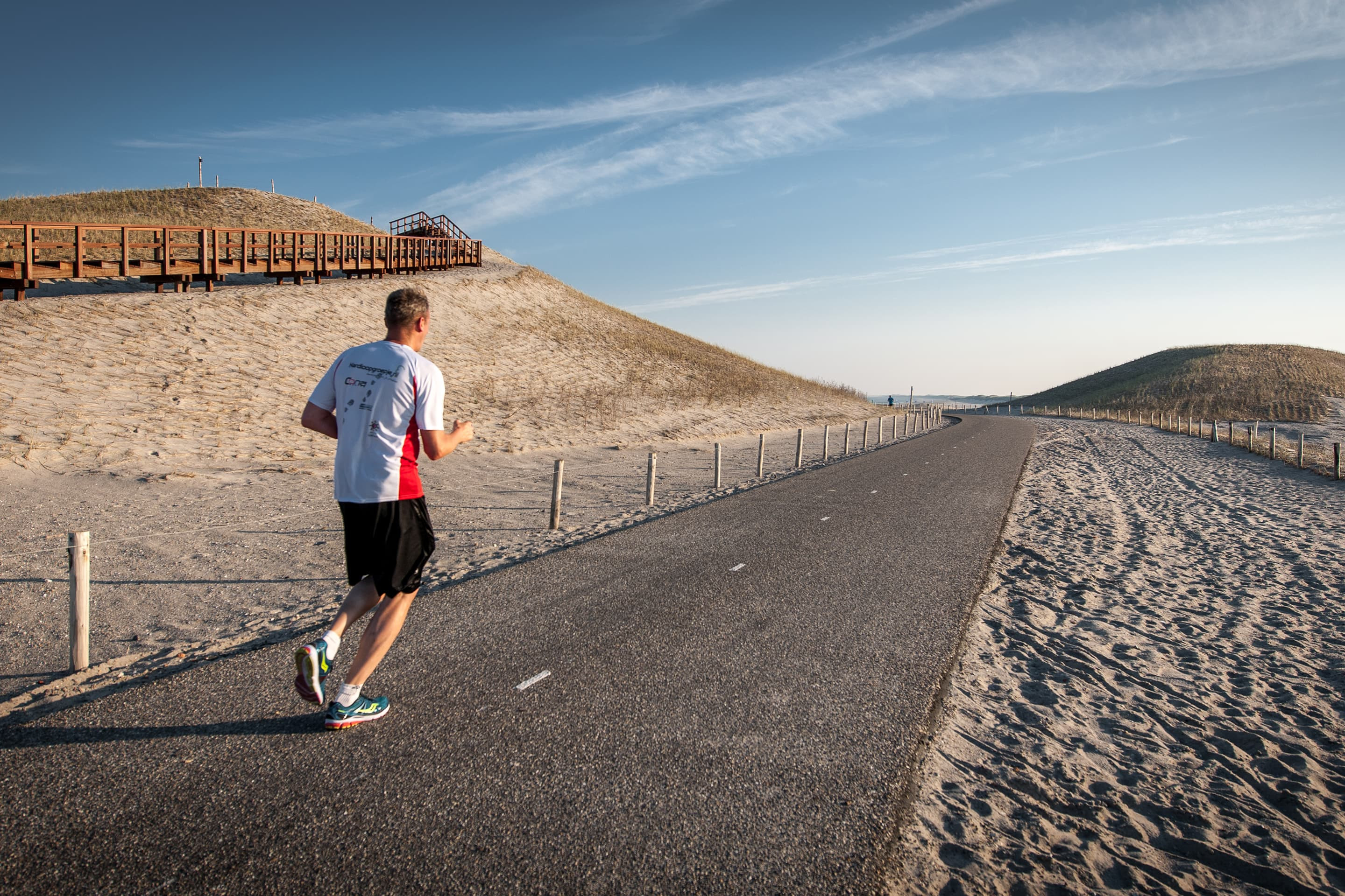
The project, which took place over 2014/15, involved the construction of a 26 meter-high ‘panoramic dune’ near Petten, a beach lagoon on the Camperduin side and a wet dune valley in the middle.
But according to Frank the project wasn’t without its challenges. “In designing this solution there were a large number of requirements and wishes that had to be taken into account in addition to safety. Not just those of the client — the Holland Noorderkwartier water control board — but also those of nature organizations and other interest groups concerned with the landscape, ecology and recreation. During the planning preparation a series of ‘coast workshops’ were arranged to give stakeholders the opportunity to contribute to the project and to build support.”
The solution we have now is highly adaptive: the dune can ‘at the touch of a button’ be widened and the beach extended.
The wet dune valley is a special element of the project. He explains: “To create this we replaced the usual high dune by an equally high, but somewhat narrower dune. In front of that we created the wet dune valley, protected by a lower, wider dune. An ingenious solution that guarantees safety, is in harmony with the prevailing ground water level, and provides great added value for nature. We expect new young dunes to form in front of the sea wall, which will provide a larger habitat for animals and plants. Additionally, the much larger beach area will attract various bird species such as the sanderling. Another advantage of the reinforcement with sand is that the nature behind the dike remains largely intact.”
The dune coast has been made strong enough to withstand a one in 10,000 year super storm. This required a total volume of around 40 million m3 of sand for the construction and maintenance over the first 20 years. The brief was to design the project in such a way that no maintenance dredging work would be required in the middle section for the first 10 years, in order to allow the full ecological recovery of the sandy soil. Frank: “We will track how the design develops and whether it lives up to expectations. The fact that we are responsible for the design, execution and 20 years’ maintenance on this project is unique.”
Please visit our website for more information on the Sand Motor.